Determine their own location using a smartphone or Navigator fraught with errors. However, according to Japanese scientists, the Japanese version of the GPS will be almost completely free from errors. August 11, orbit will display the first corresponding satellite. How will our life change?
Application of the American system
In our lives can not do without GPS. Japan is the largest country in the world using a GPS in the private sphere. However, this is an American system, which was commissioned in 1978. It was not developed in Japan.
In 1983, the airliner, Korean Air had mistakenly entered Soviet airspace, with the result that he was hit by a Soviet fighter. After this incident, the United States was allowed to use GPS for peaceful purposes, and this system has spread around the world.
The fact that the American GPS satellites cover the whole world, does not mean that they are always over the skies of Japan. Surrounded by mountains or buildings device is not always well catch the wave. Because GPS depends on the United States, changes in the international situation in the future may affect this system in Japan. Therefore, Japan is developing its own system called “Michibiki”.
The first communications satellite “Michibiki” was launched in 2010. The second — in June of this year. The third will be launched on August 11. Fourth — around October this year. Next year it will be possible to exploit the Japanese together with the American GPS. “We cannot deny the possibility that something unexpected will occur due to changes in the international situation. We want to create a system that will not depend on American GPS” — does not hide his enthusiasm, the Minister of space policy of Japan Tsuruha Yosuke (Yosuke Tsuruho).
Changing, form a figure 8
By 2023, the government of Japan will increase the number of satellites “Michibiki” to seven. Due to this, the Japanese system can work without the American GPS. However, this also does not mean that Japanese satellites will be permanently located over Japan. In one place the satellites can only be over the equator (geostationary satellite). Since Japan is located far from the equator, only geostationary satellites can not cover its territory.
Therefore, geostationary satellites 1, 2 and 4 are located on an elliptical orbit at an angle of 40 — 50 degrees, and the other three satellites will fly over Japan.
If the projected movement of the three satellites in the earth, between Japan and Australia will get a figure 8. They will not stay in the sky over Japan, and will fly over her. Such satellites are called quasi-Zenith.
Meanwhile, on 11 August will be launched the third geostationary satellite, which will be located on the equator. As three quasi-Zenith satellite, it will also send data about the position. He also will play the role of a successor satellite “Himawari-7”, which will be decommissioned in 2020.
The possibility of military use
At the GPS accuracy is around ten meters, however, the “Michibiki” it will be less than six inches. This means that the number of errors will decrease by more than 100 times. The Japanese system is characterized by high accuracy. If there are special device taking the signal, it will be possible to obtain location data. It is applicable in various lines of business.
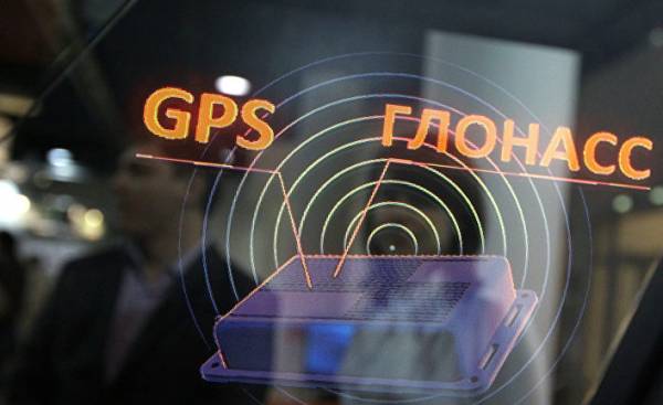
© RIA Novosti, Igor Coninternational terminal M2M-Cyber GLX, using the signals of two satellite navigation systems – Russian GLONASS and American GPSВ
Expectations are related to such areas as automated control systems of cars and agricultural machinery, transportation of goods small drones and so on. In November last year, Hitachi Zosen Corporation in Kumamoto Prefecture tested a drone on the waves “Michibiki”. The drone flew to the island can be reached within 6.5 kilometres, and back. At the same time he managed to deliver the goods to a certain place. “If the accuracy increases it will be possible to deliver cargo in locations with limited landing place”, — said the representative of the Corporation.
In November, the Cabinet of Ministers also plans to launch an unmanned bus with “Michibiki” in the Okinawa Prefecture. The government of Japan intends to use unmanned transport service in the Tokyo Olympics. With an error of ten meters, there is a danger of accidents, however, if it is to be six inches, the car can change lanes and turn without error.
In the field of satellite positioning, there is fierce global competition. In order to cover the whole world, you need 24 satellites, but according to the information of the Cabinet used for GPS 31 satellites; GLONASS — 27. Followed by the Chinese “Beidou” (20 satellites) and the European Galileo (18 satellites). The purpose of Japan is to expand the navigation business worldwide.
There are also plans to use this system in the military sphere. Shaping space programme for 2015, the government of Japan agreed that space technology will be applied in the field of security: “it is Impossible to provide a modern safety without the use of space systems”. “I can’t say that this is not possible. We will consider the specific situation”, the Minister commented Tsuruha the possibility of using “Michibiki” security.